Research Ideas
These are research ideas for students at various levels (Part II, MPhil, PhD, and postdoctoral). Browse through the ideas below to find projects that interest you. You're also welcome to propose your own research ideas that align with our ongoing projects.
Conservation Evidence Copilots

The Conservation Evidence team at the University
of Cambridge has spent years screening 1.6m+ scientific papers on conservation, as
well as manually summarising 8600+ studies relating to conservation actions.
However, progress is limited by the specialised skills needed to screen and
summarise relevant studies -- it took more than 75 person years to manually
curate the current database and only a few 100 papers can be added each year!
We are working on AI-driven techniques to accelerate addition of robust
evidence to the CE database via automated literature scanning,
Read full note... (1240 words)
- Evaluating a human-in-the-loop AI framework to improve inclusion criteria for evidence synthesis
Available and cosupervised with Alec Christie and Sadiq Jaffer - Evaluating LLMs for providing evidence-based information on conservation actions
Currently ongoing with Radhika Agrawal and cosupervised with Alec Christie and Sadiq Jaffer - Generating chunk-free embeddings for LLMs
Currently ongoing (MPhil) with Mark Jacobsen and cosupervised with Sadiq Jaffer - Accurate summarisation of threats for conservation evidence literature
Currently ongoing (MPhil) with Kittson Hamill and cosupervised with Sadiq Jaffer - Evaluating RAG pipelines for conservation evidence
Completed by Radhika Iyer and cosupervised with Sadiq Jaffer in 2000 - Crawling grey literature for conservation evidence
Completed by Shrey Biswas and Kacper Michalik and cosupervised with Sadiq Jaffer in 2000 - Assessing mangrove literature for conservation evidence
Expired (Part II) and cosupervised with Sadiq Jaffer and Tom Worthington - Spatial and multi-modal extraction from conservation literature
Expired (MPhil) and cosupervised with Sadiq Jaffer, Alec Christie and Bill Sutherland
Remote Sensing of Nature
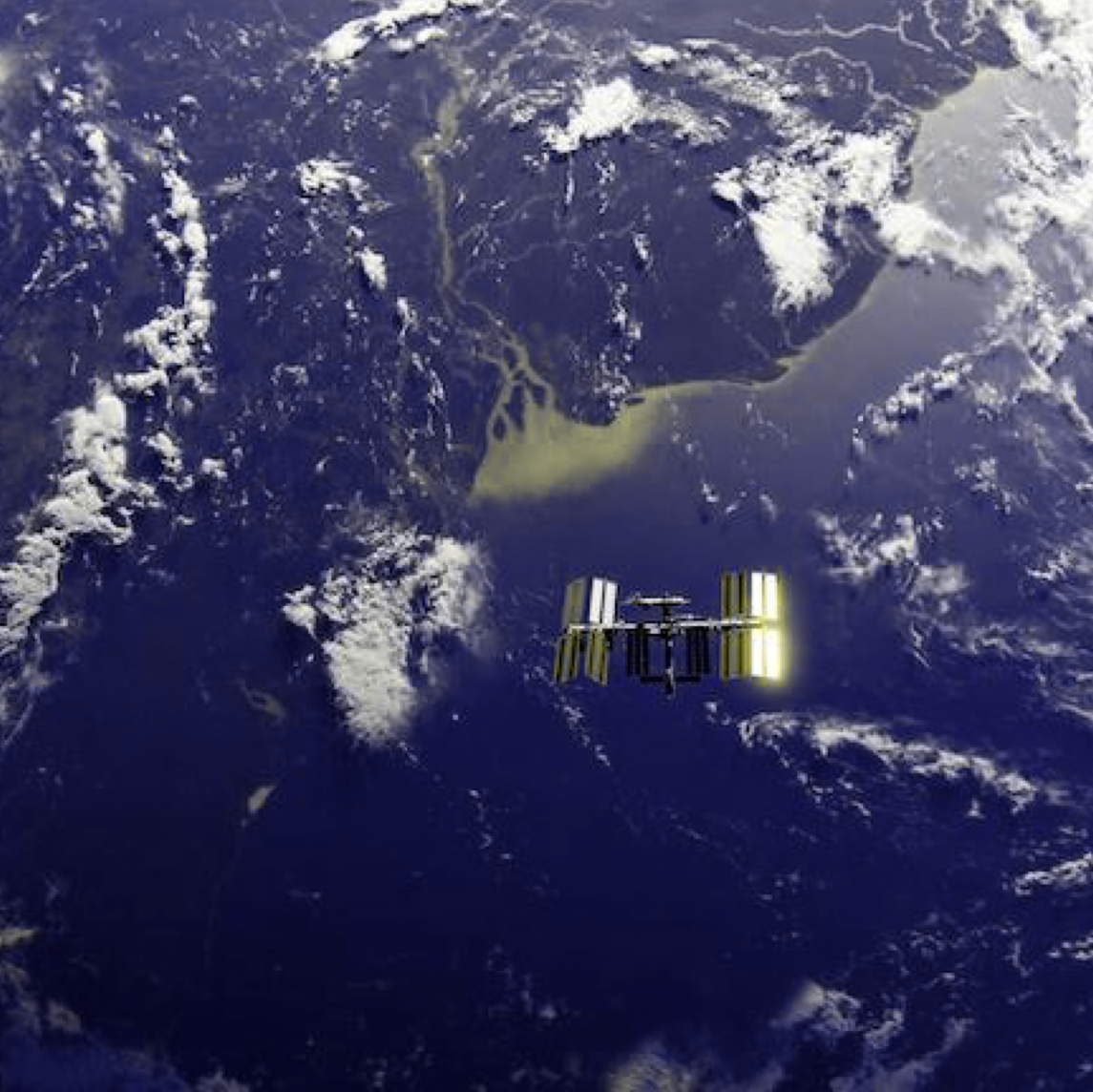
Measuring the world's forest carbon and biodiversity is made possible by remote
sensing instruments, ranging from satellites in space (Landsat, Sentinel, GEDI)
to ground-based sensors (ecoacoustics, camera traps, moisture sensors) that
take regular samples and are processed into time-series metrics and actionable
insights for conservation and human development. However, the algorithms for
processing this data are challenging as the data is highly multimodal
(multispectral, hyperspectral, synthetic aperture radar, or lidar), often
sparsely sampled spatially, and not in a continuous time series. I work on
various algorithms and software and hardware systems we are developing to
improve the datasets we have about the surface of the earth, in close
collaboration with the
Read full note... (1323 words)
- Validating predictions with ranger insights to enhance anti-poaching patrol strategies in protected areas
Currently ongoing with Hannah McLoone and cosupervised with Charles Emogor and Rob Fletcher - Mapping urban and rural British hedgehogs
Currently ongoing with Gabriel Mahler and cosupervised with Silviu Petrovan - Habitat mapping of the Cairngormes Connect restoration area
Currently ongoing with Isabel Mansley and cosupervised with David Coomes and Aland Chan - Battery-free wildlife monitoring with Riotee
Currently ongoing with Dominico Parish and cosupervised with Josh Millar - Enhancing Navigation Algorithms with Semantic Embeddings
Currently ongoing (MPhil) with Gabriel Mahler - Affordable digitisation of insect collections using photogrammetry
Currently ongoing (MPhil) with Beatrice Spence, Arissa-Elena Rotunjanu and Anna Yiu and cosupervised with Tiffany Ki and Edgar Turner - The role of urban vegetation in human health
Currently ongoing (PhD) with Andres Zuñiga-Gonzalez and cosupervised with Ronita Bardhan - Foundation models for complex geospatial tasks
Currently ongoing (PhD) with Onkar Gulati and cosupervised with Sadiq Jaffer and David Coomes - Low-power sensing infrastructure for biodiversity
Currently ongoing (PhD) with Josh Millar and cosupervised with Hamed Haddadi - Mapping hunting risks for wild meat in protected areas
Currently ongoing with Charles Emogor and cosupervised with Milind Tambe - Species distribution modelling using CNNs
Completed (MPhil) by Emily Morris and cosupervised with David Coomes in 2000 - Reverse emulating agent-based models for policy simulation
Completed (MPhil) by Pedro Sousa and cosupervised with Sadiq Jaffer in 2000 - Exploring Concurrency in Agent-Based Modelling with Multicore OCaml
Completed (Part II) by Martynas Sinkievič in 2000 - Scalable agent-based models for optimized policy design
Completed (MPhil) by Sharan Agrawal and cosupervised with Srinivasan Keshav in 2000 - Diffusion models for terrestrial predictions about land use change
Expired (MPhil) and cosupervised with Sadiq Jaffer
Mapping LIFE on Earth
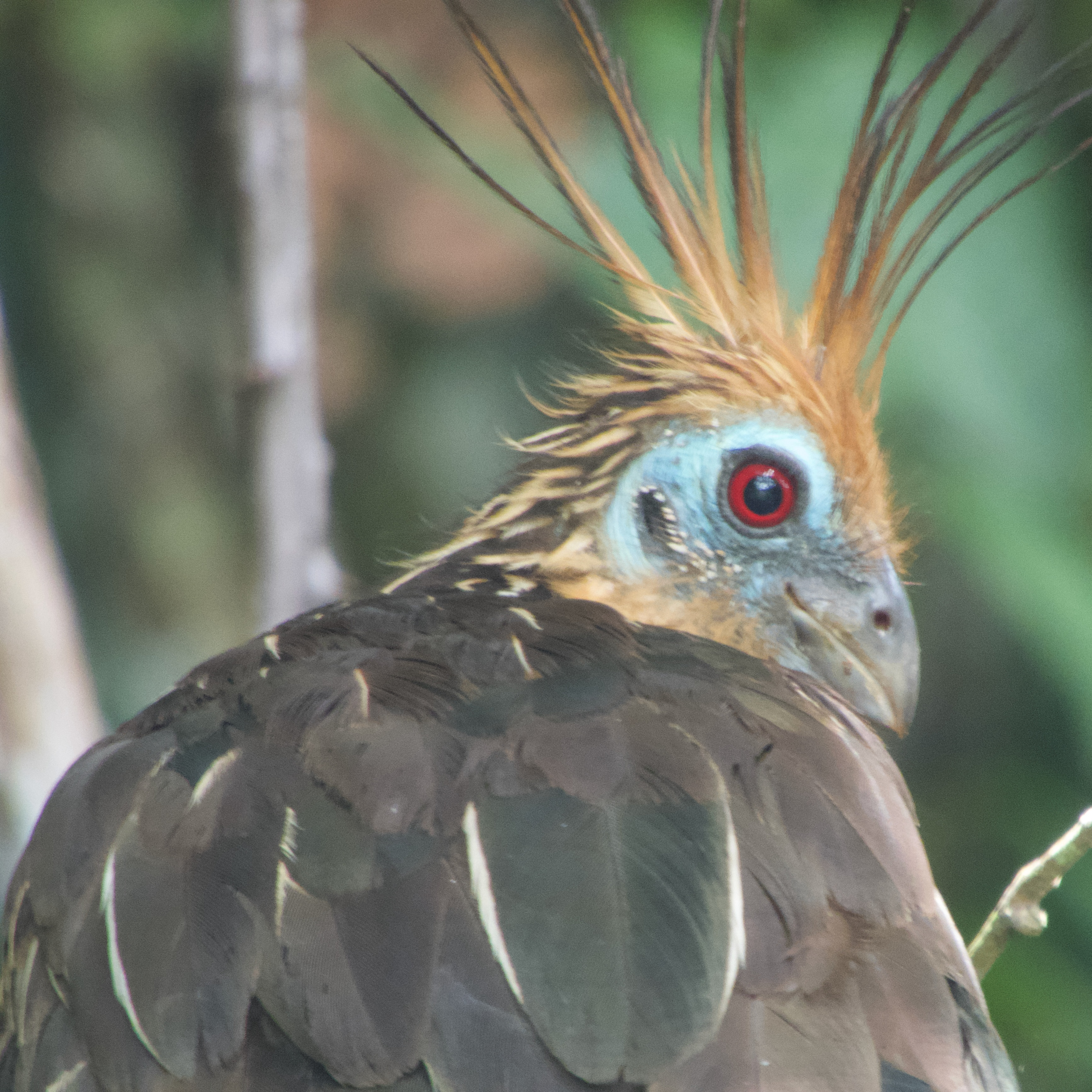
Human-driven habitat loss is recognised as the greatest cause of biodiversity loss, but we lack robust, spatially explicit metrics quantifying the impacts of anthropogenic changes in habitat extent on species' extinctions. LIFE is our new metric that uses a persistence score approach that combines ecologies and land-cover data whilst considering the cumulative non-linear impact of past habitat loss on species' probability of extinction. We apply large-scale computing to map ~30k species of terrestrial vertebrates and provide quantitative estimates of the marginal changes in the expected number of extinctions caused by converting remaining natural vegetation to agriculture, and also by restoring farmland to natural habitat. We are also investigating many of the conservation opportunities opened up via its estimates of the impact on extinctions of diverse actions that change land cover, from individual dietary choices through to global protected area development.
Read full note... (1141 words)
- An access library for the world crop, food production and consumption datasets
Available and cosupervised with Alison Eyres and Thomas Ball - Using graph theory to define data-driven ecoregion and bioregion maps
Available and cosupervised with Daniele Baisero and Michael Dales - Using wasm to locally explore geospatial layers
Currently ongoing (Part II) with Sam Forbes and cosupervised with Michael Dales - Real-time mapping of changes in species extinction risks
Currently ongoing (PhD) with Emilio Luz-Ricca and cosupervised with Andrew Balmford
Planetary Computing
Planetary computing is our research into the systems required to handle the
ingestion, transformation, analysis and publication of global data products for
furthering environmental science and enabling better informed policy-making. We
apply computer science to problem domains such as forest carbon and
biodiversity preservation (see
Read full note... (1178 words)
- Autoscaling geospatial computation with Python and Yirgacheffe
Available and cosupervised with Michael Dales - Using computational SSDs for vector databases
Available (MPhil) and cosupervised with Sadiq Jaffer - ZFS replication strategies with encryption
Currently ongoing with Becky Terefe-Zenebe and cosupervised with Mark Elvers - Bidirectional Hazel to OCaml programming
Currently ongoing with Max Carroll and cosupervised with Patrick Ferris and Cyrus Omar - Gradually debugging type errors
Currently ongoing (Part II) with Max Carroll and cosupervised with Patrick Ferris - An imperative, pure and effective specification language
Currently ongoing (Part II) with Max Smith and cosupervised with Patrick Ferris - Effective geospatial code in OCaml
Currently ongoing (Part II) with George Pool and cosupervised with Michael Dales and Patrick Ferris - Privacy preserving emissions disclosure techniques
Currently ongoing (PhD) with Jessica Man and cosupervised with Martin Kleppmann - Computational Models for Scientific Exploration
Currently ongoing (PhD) with Patrick Ferris and cosupervised with Srinivasan Keshav - Assessing high-performance lightweight compression formats for geospatial computation
Completed (MPhil) by Omar Tanner and cosupervised with Sadiq Jaffer in 2000 - Towards reproducible URLs with provenance
Expired (Part II) and cosupervised with Patrick Ferris - Composable diffing for heterogenous file formats
Expired (MPhil) and cosupervised with Patrick Ferris
Trusted Carbon Credits
The Cambridge Centre for Carbon Credits is an initiative I started with
Read full note... (1052 words)
- Making GPS accurate in dense forests using sensor fusion
Completed by Keshav Sivakumar and cosupervised with Srinivasan Keshav and David Coomes in 2000 - Meta Properties of Financial Smart Contracts
Completed (PhD) by Derek Sorensen and cosupervised with Srinivasan Keshav in 2000 - Legal perspectives on integrity issues in forest carbon
Completed by Sophie Chapman and cosupervised with Eleanor Toye Scott in 2000
Information Flow for Trusted Execution
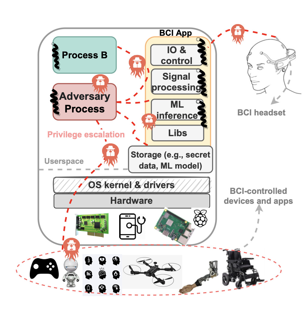
There is now increased hardware support for improving the security and performance of privilege separation and compartmentalization techniques such as process-based sandboxes, trusted execution environments, and intra-address space compartments. We dub these "hetero-compartment environments" and observe that existing system stacks still assume single-compartment models (i.e. user space processes), leading to limitations in using, integrating, and monitoring heterogeneous compartments from a security and performance perspective. This project explores how we might deploy techniques such as fine-grained information flow control (DIFC) to allow developers to securely use and combine compartments, define security policies over shared system resources, and audit policy violations and perform digital forensics across hetero-compartments.
- Void Processes: Minimising privilege by default
Completed (MPhil) by Jake Hillion in 2000 - Decentralised Capability-based Code Collaboration using Matrix
Completed (Part II) by Samuel Wedgwood in 2000 - Secure Programming with Dispersed Compartments
Completed (PhD) by Zahra Tarkhani in 2000 - Security analysis of brain-computing interfaces
Completed by Malachy O'Connor Brown and Oscar Hill and cosupervised with Zahra Tarkhani and Lorena Qendro in 2000
Interspatial OS

Digital infrastructure in modern urban environments is currently very Internet-centric, and involves transmitting data to physically remote environments. The cost for this is data insecurity, high response latency and unpredictable reliability of services. I am working on Osmose -- a new OS architecture that inverts the current model by building an operating system designed to securely connect physical spaces with extremely low latency, high bandwidth local-area computation capabilities and service discovery.
- Low power audio transcription with Whisper
Currently ongoing with Dan Kvit and cosupervised with Josh Millar - 3D printing the planet (or bits of it)
Currently ongoing with Finley Stirk and cosupervised with Michael Dales - Low-latency wayland compositor in OCaml
Currently ongoing (Part II) with Tom Thorogood and cosupervised with Ryan Gibb - Building bigraphs of the real world
Currently ongoing (Part II) with Roy Ang and cosupervised with Ryan Gibb - Interspatial Networking with DNS
Currently ongoing (PhD) with Ryan Gibb and cosupervised with Jon Crowcroft - Spatial Name System
Completed (MPhil) by Ryan Gibb and cosupervised with Jon Crowcroft in 2000 - Scheduling for Reduced Tail Latencies in Highly Utilised Datacenters
Completed (PhD) by Smita Vijayakumar and cosupervised with Evangelia Kalyvianaki in 2000 - A DSL for decentralised identity in OCaml
Completed (Part II) by Michał Mgeładze-Arciuch and cosupervised with Patrick Ferris in 2000 - Deep learning for decomposing sound into vector audio
Expired (MPhil) and cosupervised with Trevor Agus
OCaml Labs
I founded a research group called OCaml Labs at the University of Cambridge, with the goal of pushing OCaml and functional programming forward as a platform, making it a more effective tool for all users (including large-scale industrial deployments), while at the same time growing the appeal of the language, broadening its applicability and popularity. Over a decade, we retrofitted multicore parallelism into the mainline OCaml manager, wrote a popular book on the language, and helped start and grow an OCaml package and tooling ecosystem that is thriving today.
Read full note... (1931 words)
- A hardware description language using OCaml effects
Available (MPhil) and cosupervised with KC Sivaramakrishnan and Andy Ray - Runtimes à la carte: crossloading native and bytecode OCaml
Currently ongoing with Jeremy Chen and cosupervised with David Allsopp - Effects based scheduling for the OCaml compiler pipeline
Currently ongoing with Lucas Ma and cosupervised with David Allsopp - Analysis of the Raft Consensus Protocol
Completed (Part II) by Heidi Howard in 2000 - Probabilistic Programming in OCaml
Completed (Part II) by Hari Chandrasekaran and cosupervised with Tom Kelly and Liang Wang in 2000 - Using effect handlers for efficient parallel scheduling
Completed (MPhil) by Bartosz Modelski in 2000 - Macro- and Micro-benchmarking in OCaml
Completed (Part II) by Sebastian Funk in 2000 - Functional Reactive Web Applications
Completed (Part II) by Henry Hughes in 2000 - Parallel traversal effect handlers for OCaml
Completed (Part II) by Sky Batchelor and cosupervised with Patrick Ferris in 2000 - Concurrent revisions for OCaml
Completed (Part II) by Dimitar Popov in 2000 - Implementing a higher-order choreographic language
Completed (Part II) by Rokas Urbonas and cosupervised with Dmirtij Szamozvancev in 2000
Unikernels

I proposed the concept of "unikernels" -- single-purpose appliances that are compile-time specialised into standalone bootable kernels, and sealed against modification when deployed to a cloud platform. In return they offer significant reduction in image sizes, improved efficiency and security, and reduce operational costs. I also co-founded the MirageOS project which is one of the first complete unikernel frameworks, and also integrated them to create the Docker for Desktop apps that are used by hundreds of millions of users daily.
Read full note... (1565 words)
- Control flow analysis for privilege separation
Completed by Chris Harding and Ross McIlroy and cosupervised with Robert M Watson in 2000 - Consolidating Trust for Client Groups that use TLS to Secure Connections
Completed (Part II) by Johann Beleites and cosupervised with David Sheets in 2000 - Extending 64-bit MIPS support for LLVM
Completed by William Morland and cosupervised with Robert M Watson in 2000 - A strongly consistent index for email using git and MirageOS
Completed (Part II) by Oliver Hope and cosupervised with David Allsopp in 2000 - Distributed Task Scheduling Framework over Irmin
Completed (Part II) by Mohammed Daudali in 2000 - CausalRPC: a traceable distributed computation framework
Completed (Part II) by Craig Ferguson in 2000
Personal Containers

As cloud computing empowered the creation of vast data silos, I investigated how decentralised technologies might be deployed to allow individuals more vertical control over their own data. Personal containers was the prototype we built to learn how to stem the flow of our information out to the ad-driven social tarpits. We also deployed personal containers in an experimental data locker system at the University of Cambridge in order to incentivise lower-carbon travel schemes.
- Simulating XMPP Group Communication
Completed (Part II) by Farhān Mannān in 2000 - Improving Resilience of ActivityPub Services
Completed (Part II) by Gediminas Lelešius in 2000
Ubiquitous Interaction Devices

I investigated how to interface the new emerging class of smartphone devices (circa 2002) with concepts from ubiquitous computing such as location-aware interfaces or context-aware computing. I discovered the surprisingly positive benefits of piggybacking on simple communications medium such as audible sound and visual tags. Our implementations of some of these ended up with new audio ringtone and visual smart tags that worked on the widely deployed mobile phones of the era.
In 2003, the mobile phone market had grown tremendously and given the average consumer access to cheap, small, low-powered and constantly networked devices that they could reliably carry around. Similarly, laptop computers and PDAs became a common accessory for businesses to equip their employees with when on the move. The research question then, was how to effectively interface them with existing digital infrastructure and realise some of the concepts of ubiquitous computing such as location-aware interfaces or context-aware computing.
Read full note... (1178 words)
- Audio networking using commodity hardware
Completed (Part II) by Gareth P. Williams in 2000
Functional Internet Services
My PhD dissertation work proposed an architecture for constructing new implementations of standard Internet protocols with integrated formal methods such as model checking and functional programming that were then not used in deployed servers. A more informal summary is "rewrite all the things in OCaml from C!", which lead to a merry adventure into implementing many networks protocols from scratch in a functional style, and learning lots about how to enforce specifications without using a full blown proof assistant.
Read full note... (1092 words)
- Not-quite-so-broken TLS in OCaml
Completed by Hannes Mehnert and David Kaloper-Mersinjak and cosupervised with Peter Sewell in 2000 - Functional ABNF parser generators
Completed (Part II) by Nicholas Skehin in 2000