
I can't believe it's been a whole year since we released the first GeoTessera library to make the TESSERA embeddings easier to get your mittens on. Quite a lot of adoption has happened since! I'm going to quickly review a year of embedding requests and the people who filed them, explain the move to the Source Cooperative for our hosting, what the Zarr upgrades with UTM routing and matryoshka entail, how the CLI works, and show you a guided tour that builds a land classifier and sonar panel detector.

1 A year of embedding requests
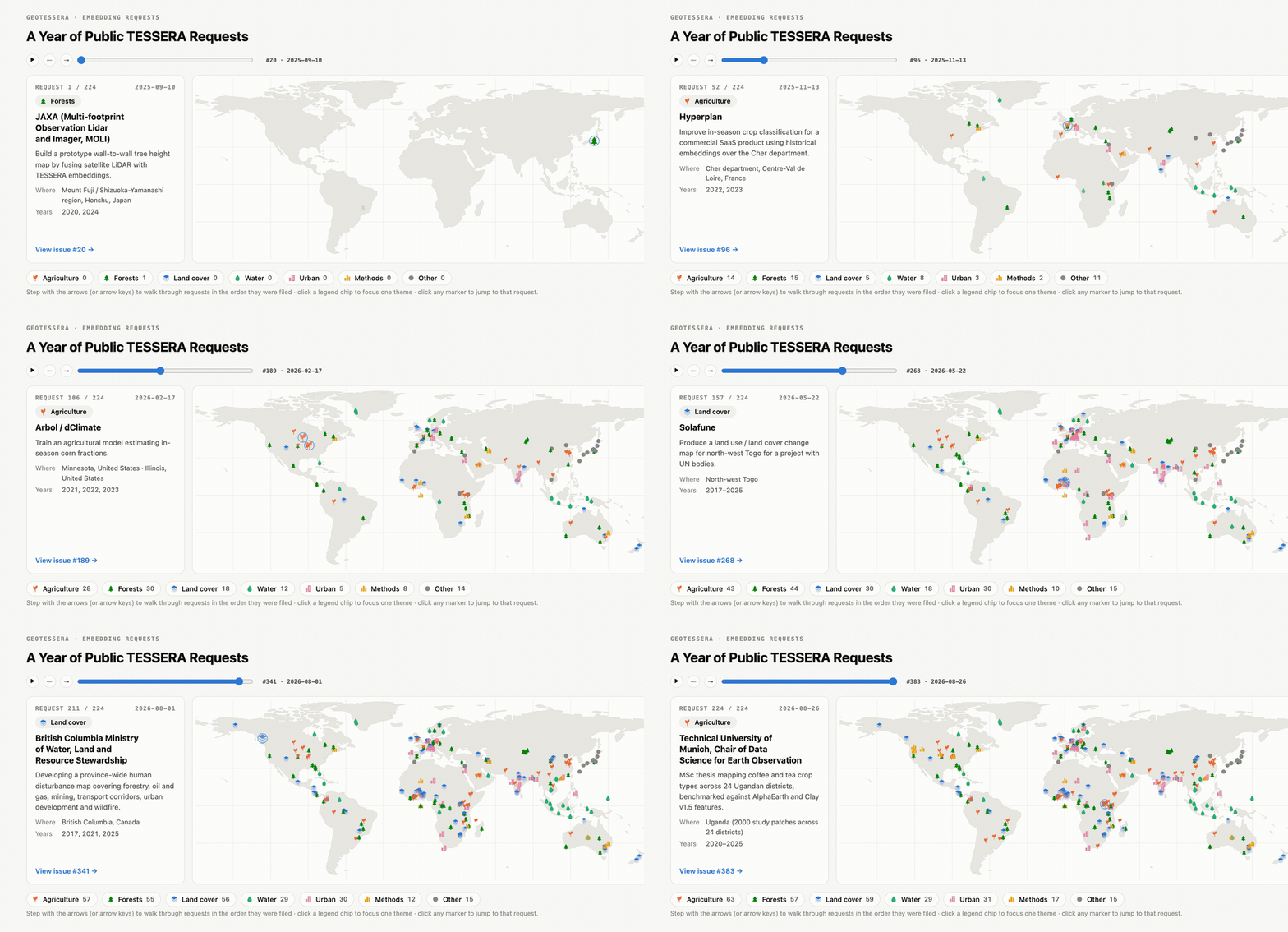
Because we didn't have enough GPUs to pre-generate embeddings for everywhere in the world, we opened up our GitHub repo for people to request priority map areas they needed. This turned out to be a great way for us to meet our users and build community; there have been people from all over the globe getting in touch!
Geographically, most of the world is covered, and thematically the requests span agriculture, forests, land cover, water and urban mapping. From a machine learning perspective this involves downstream classification, segmentation and regression tasks from the same model embeddings. Here's a sample of what people are doing:
- Tree species mapping in temperate mountain forests, where the embeddings need far fewer field plots than a conventional geospatial pipeline.
- Groundnut basin of Senegal crop type classification for smallholder agriculture.
- Côte d'Ivoire has the EU Joint Research Centre asking whether sub-metre resolution is really necessary for cocoa mapping, benchmarking Tessera against 0.5m Pleiades imagery.
- Five Swiss cities for fine-scale local climate zone mapping, upscaling coarse 100m LCZ records to 10m.
- The Netherlands has a tree species classification for the Dutch national forest inventory.
- There's an analysis of 219 flood events across 65 countries via GEOID-Flood, a Copernicus emergency-management benchmark where a 129-parameter linear probe on top of the embeddings works as a strong flood segmenter.
Klemmer et al did a great review of Earth embeddings as a category of their own for those who want to learn more about the field.
Thank you to everyone who took the trouble to file a request with us or write a paper about it, and please keep them coming as we roll out Tessera v2 as well this year!
2 GeoTessera 0.10 and the move to Source Cooperative
I've also just released GeoTessera 0.10.0 with a quick 0.10.1 followup today after Aneesh Naik, Michael Dales and Sadiq Jaffer immediately found some rough edges as they ported their code.
The main feature is that all our hosting is no longer hammering Cambridge private servers, but now goes through the Source Cooperative and is fronted by CloudFlare edge caching. The source.coop/tessera/tessera remote replaces the AWS bucket we temporarily moved to earlier this year. We desperately need our Cambridge storage capacity back as we develop new models, so the older endpoints will be switched off shortly.
For our users, the primary benefit here is stability and lower latency access that's more 'cloud native'. If you've got a lot of resources and are running on AWS or Azure, you'll find you're closer to the Tessera data. On the other hand, when I was in India running the Tessera hackathon with IIT-Delhi at the AI Impact Summit, the performance was abysmal due to the India-Cambridge link being slow. That should now be much improved due to CloudFlare having plenty of edge caching all over the world. If not, let me know!
3 Zarr conversions for v1 and v2 beta access
The Zarr Tessera wrapper has also had a big overhaul. The key benefit of Zarr is that
no downloads are needed as the client can stream data directly over HTTP. Since the
v3 layout work and the geo-embeddings convention proposal earlier this year, our Zarr store has been
UTM-native to minimise coordinate skew around the globe. This works via utmNN Zarr
sub-groups that contain the tiles for that particular slice of the world.
The GeoTesseraZarr zarr wrapper now routes global lon/lats to the right UTM
zone subgroup that actually contains the requested point. This is only necessary near
the seams of UTM zones where a point might be on either side.
The other new preview feature (only for v2 embeddings) is support for the "Matryoshka embeddings" that we trained that new model with, following on from v1.1. The first 4 and the first 16 dimensions of a v2 embedding can be plucked out of the Zarr store independently of the full 128 dimensions, making it much easier to do a quick sample analysis.
The 0.10.1 follow-up release was to fix caching in the Zarr. GeoTesseraZarr now accepts a cache_dir=
argument and calculates a cache key that disambiguates different model versions
so they never clash. There are also minor fixes to make it easier to use local
filesystems (Ceph in our case) which really don't like large directory reads.
4 The geotessera CLI
The CLI is also quite handy to interactively do some tasks.
uvx geotessera info will tell you which variants are published; and you can also
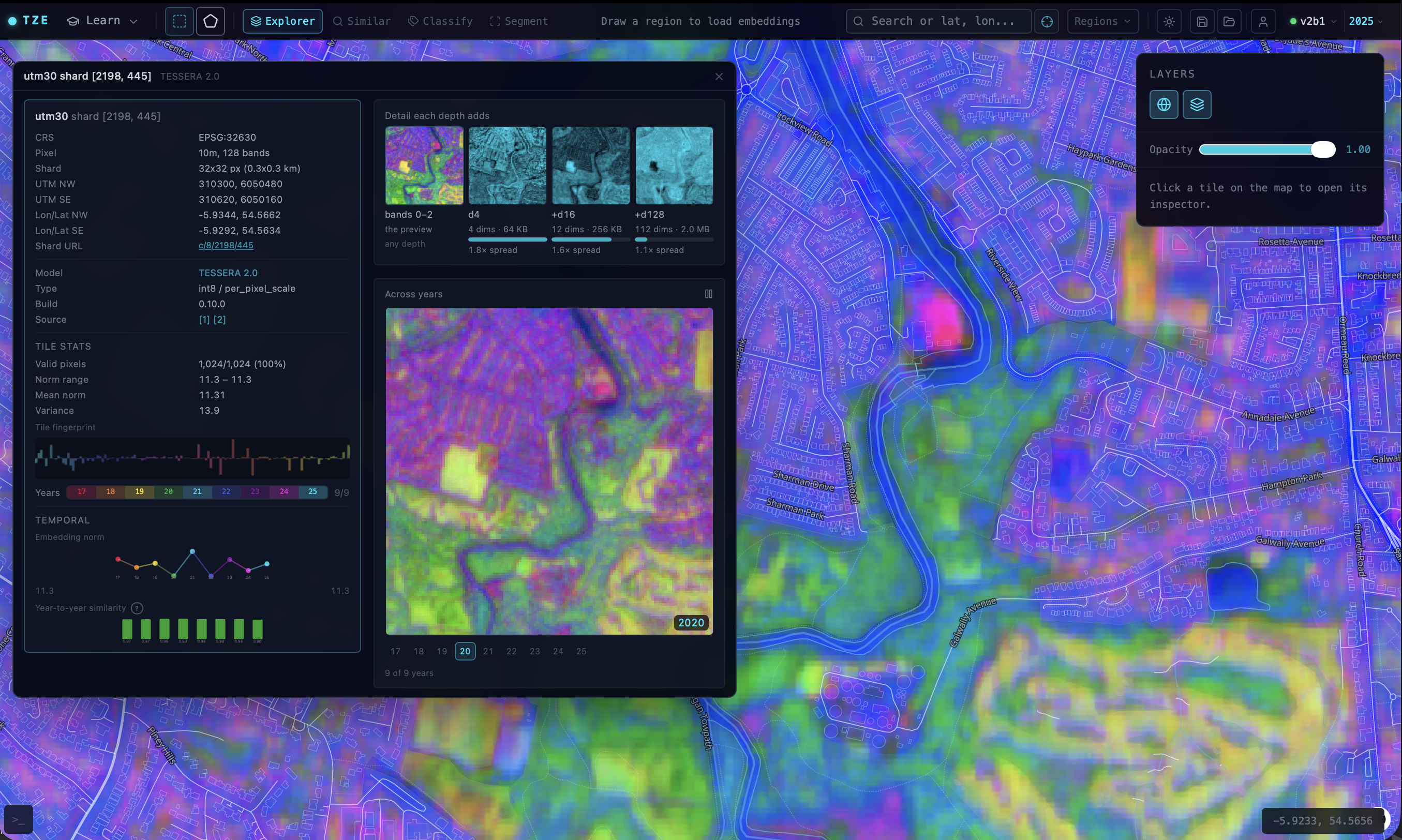
poke at them interactively at tze.geotessera.org.
Just click on the top right 'model version' button to switch to v2.
$ uvx geotessera info
╭─────────┬──────────────────────┬────────────────┬─────────────╮
│ Version │ Variant              │ Repository dir │ Status      │
├─────────┼──────────────────────┼────────────────┼─────────────┤
│ 1.0     │ vultr (default)      │ v1             │ available   │
│ 1.1     │ cambridge (default)  │ v1.1-cam       │ available   │
│ 1.1     │ dclimate             │ -              │ coming soon │
│ 2.0     │ 2B-L~beta1 (default) │ v2-2B-L~beta1  │ available   │
│ 2.0     │ 2B-L~beta2           │ v2-2B-L~beta2  │ available   │
╰─────────┴──────────────────────┴────────────────┴─────────────╯
Note that the v2 ones will have very little coverage as we're still exploring different inference strategies. V1.1 is going through a complete global run at the moment by dClimate, so those should be available en mass in September sometime.
5 A quick guided tour
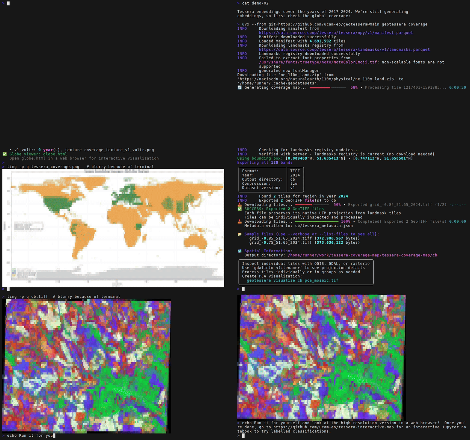
I've put together a ucam-eo/geotessera-examples repository to provide a little teaching tour, after Michael Dales asked for one a while back. The first of these is a land-cover classifier for any point on Earth:
uv run 01_classify.py --lon 0.12 --lat 52.20 # Cambridge, obviously
This is a single Python file, so one uv command fetches the dependencies and
runs it directly. There are four main dependencies: geotessera (obviously)
to fetch embeddings for a patch of land, and then osmnx
to fetch labels from OpenStreetMap as ground truth, then rasterio
to line the labels up and turn them into pictures, and finally scikit-learn
to learn the mapping between the labels and embeddings.
To fetch the embeddings, GeoTesseraZarr is the client for the Zarr store. We
just hand it a lon/lat bounding box and it works out which UTM zone and tiles
it needs, streams just those chunks over HTTP through the magic of Zarr, and
gives you back a numpy array with 128 floats per 10m pixel.
gt = GeoTesseraZarr(zarr_store_url("v2"), cache_dir="tessera-cache")
mosaic, transform, crs = gt.read_region((west, south, east, north), year)
Then we need some labels. The easiest ground truth for a bounding box is to
grab OpenStreetMap ones. osmnx issues a single
Overpass query (Overpass being
OSM's query service) and gets back vector outlines of water, woodland, farmland,
buildings and roads.
Those outlines then have to become pixels, which is what rasterio is for. It
paints them onto the same grid as the embeddings, using the coordinate
transform that read_region gives us:
features = ox.features.features_from_bbox(bbox=bbox, tags=OSM_TAGS).to_crs(crs)
rasterize([(g, class_id) for g in shapes], out=labels, transform=transform)
That shared grid is pretty much all that's needed to do some basic machine learning using a KNN:
knn = KNeighborsClassifier(n_neighbors=5).fit(x_fit, y_fit)
logreg = LogisticRegression(max_iter=2000).fit(scaler.transform(x_fit), y_fit)
The remainder of the guided tour runs the same classifier using the v2 beta model at a depth of 16, as well as the full 128 dimensions, and compares the accuracy for you.
For regions too big to hold in memory there is also an iter_region function now,
which splits the mosaic into row strips while prefetching the next one. There's
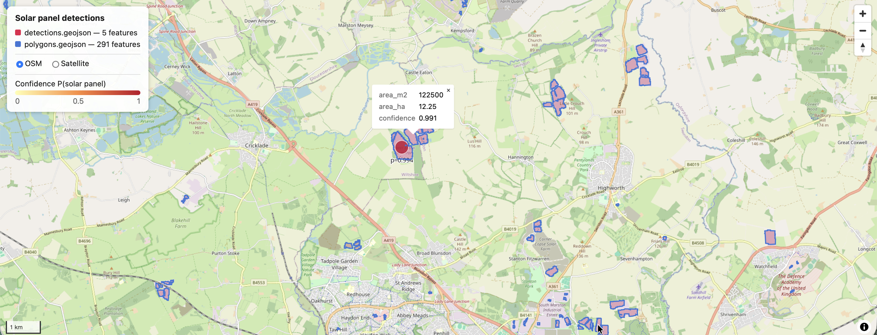
a solar panel detection
example that pushes that to lots of pixels without materialising all of them at once;
Sadiq Jaffer first demoed this in his PROPL talk last year.
Once you get into segmentation, check out Sadiq Jaffer writing about the innards of tiny CNNs over Tessera to brew your own variations.
6 Go forth and find your own tasks
All you need is pip install geotessera or uvx geotessera to invoke the CLI.
The examples repository is a good place to start. The GeoTessera documentation covers the full API. Our EEG Zulip has several public channels to reach out to for more interactive help.
For the agentic hackers among you, there's also a Claude Code plugin in the
repository now. Just type /plugin in Claude Code and add ucam-eo/geotessera
and activate the resulting geotessera plugin to get you going.
Here's to another year of geospatial fun! Happy birthday Tessera!