With term in full swing, I caught the traditional head cold and mostly lost my voice after giving many lectures this week! It's inevitable for me to catch one every first term; I hear a chorus of coughing from the 1A FoCS students by the second week, and I fall like clockwork in the third.
Still, it's been very fun being back in Pembroke again after sabbatical and I wrote in more detail about three different events this term there, covering the computer science subject dinner, the weekly Evidence TAP "samosa socials" to encourage interdisciplinary conversations, and admitting two new honorary fellows.
Two of the Part II students have started keeping public weeknotes, which I'm delighted to see! Matt Occleshaw is writing his notes on the embedded OCaml DSL for OpenStreetMap. Finley Stirk is restarting his weeknotes after his UROP work this summer on GPS uncertainty in GBIF point labels for Tessera. I'm watching Matt's progress on OpenStreetMap with interest since I've also been looking into OpenStreetMap mirroring for my UK label database below. And Cyrus Omar has also refreshed his website with weeknotes for his sabbatical.
In the rest of this week's notes, I headed to London to keynote the OpenUK Space Tech Radar launch and came back with the start of a UK label map for Tessera that might be shared via Tangled, with Tessera also shortlisted for an OpenUK award this coming week. There are some papers and talks in progress, and the links around the web are mostly about AI in academic writing this week.
1 Keynoting the OpenUK Space Tech Radar
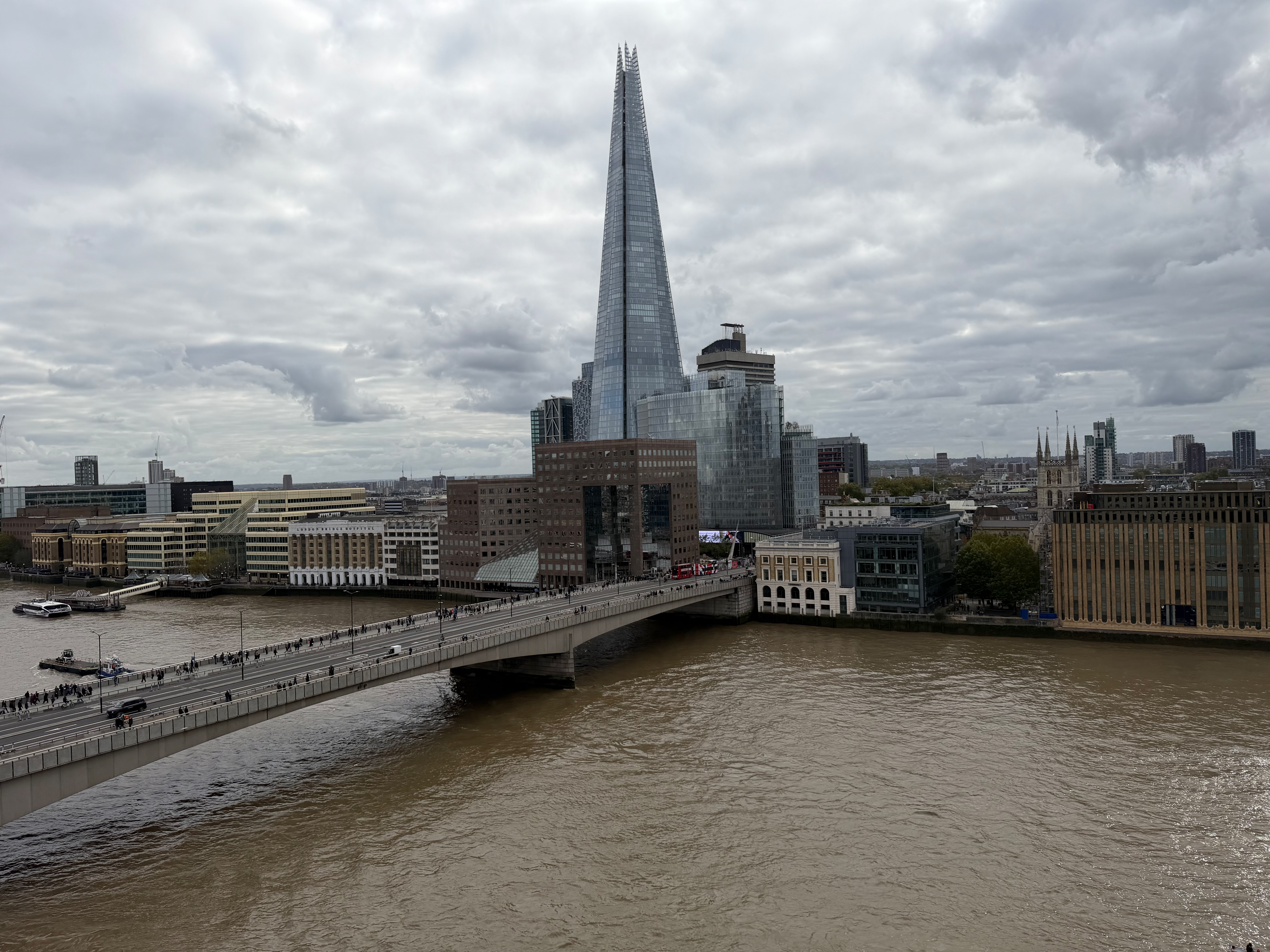
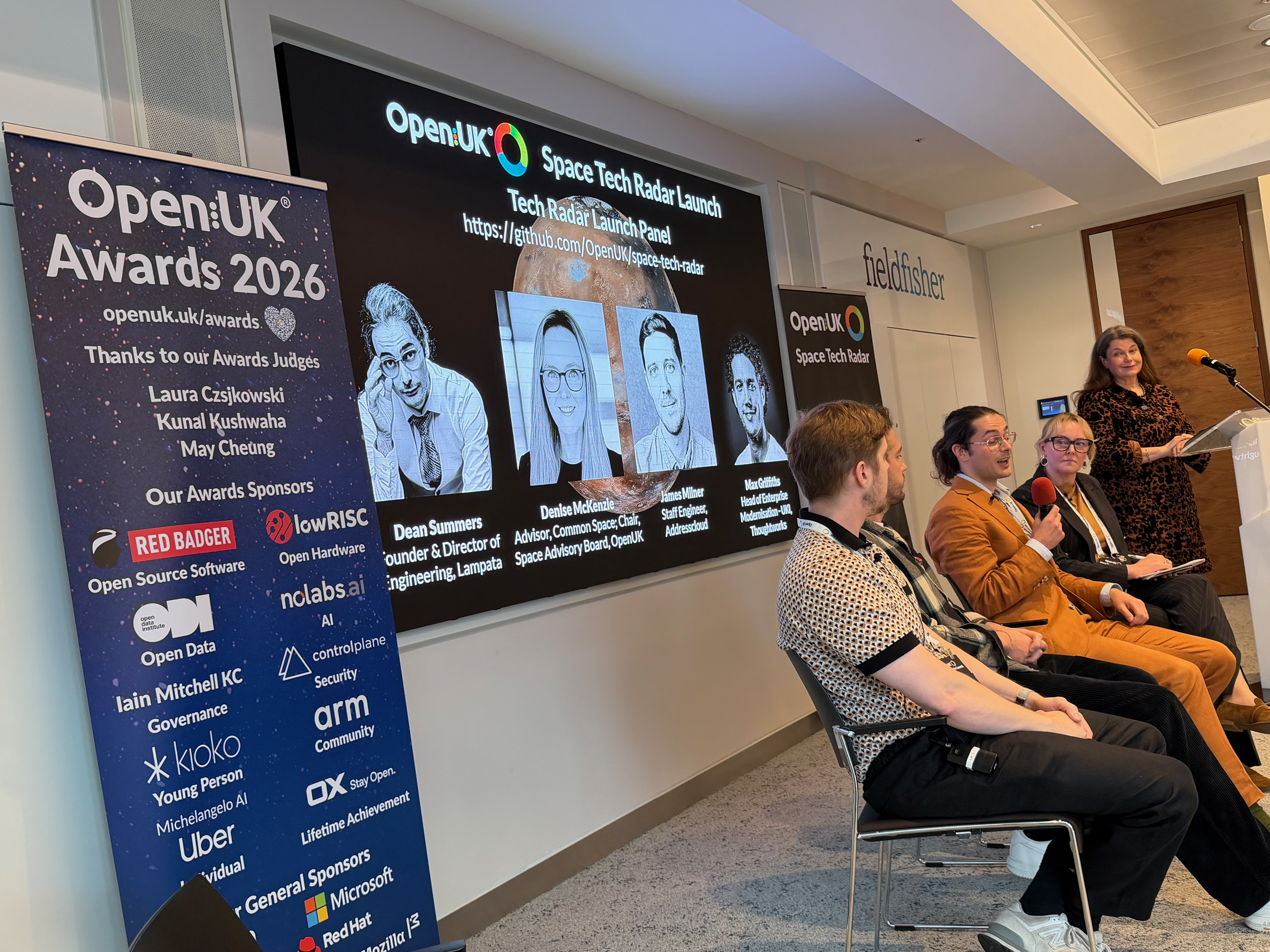
My talk was on using open geo-foundation models like Tessera to find life on Earth. I was also delighted to meet Simon Wardley at long last, since I've almost crossed paths with him many times after his early work on virtualisation, containers and now on strategy maps! This event follows on from the AI Openness report conversations with OpenUK earlier this year.
2 A UK label map for Tessera
The crowd at the Space Tech Radar launch was well into finding ways to use Tessera. On the train back, I started pulling together the proper label database with a specific focus on the UK. My aim is to harmonise the many sources of ground truth labels we use for habitat and urban mapping into one place, since every dataset I encounter has subtle variations in schema, coordinate conventions and notion of uncertainty. This builds on the OpenStreetMap, GBIF and iNaturalist raw mirror I set up a couple of weeks ago.
The UK has an incredible wealth of open data available, and I discovered that the government portal has been turned into a National Data Library of the sort that I speculated about last year! So far my label db involves a large sync of:
- OpenStreetMap for the built and natural environment features.
- GBIF species occurrence records, which ties in with Finley's project on their GPS uncertainty.
- ESA WorldCover land cover classes that cover 2020/2021 at a 10m resolution (a good fit for Tessera).
- The Environment Agency's hydrology data via their API portal, for rivers, flows and water levels across England. Wales, Scotland and Northern Ireland aren't covered by these but I'm working on those.
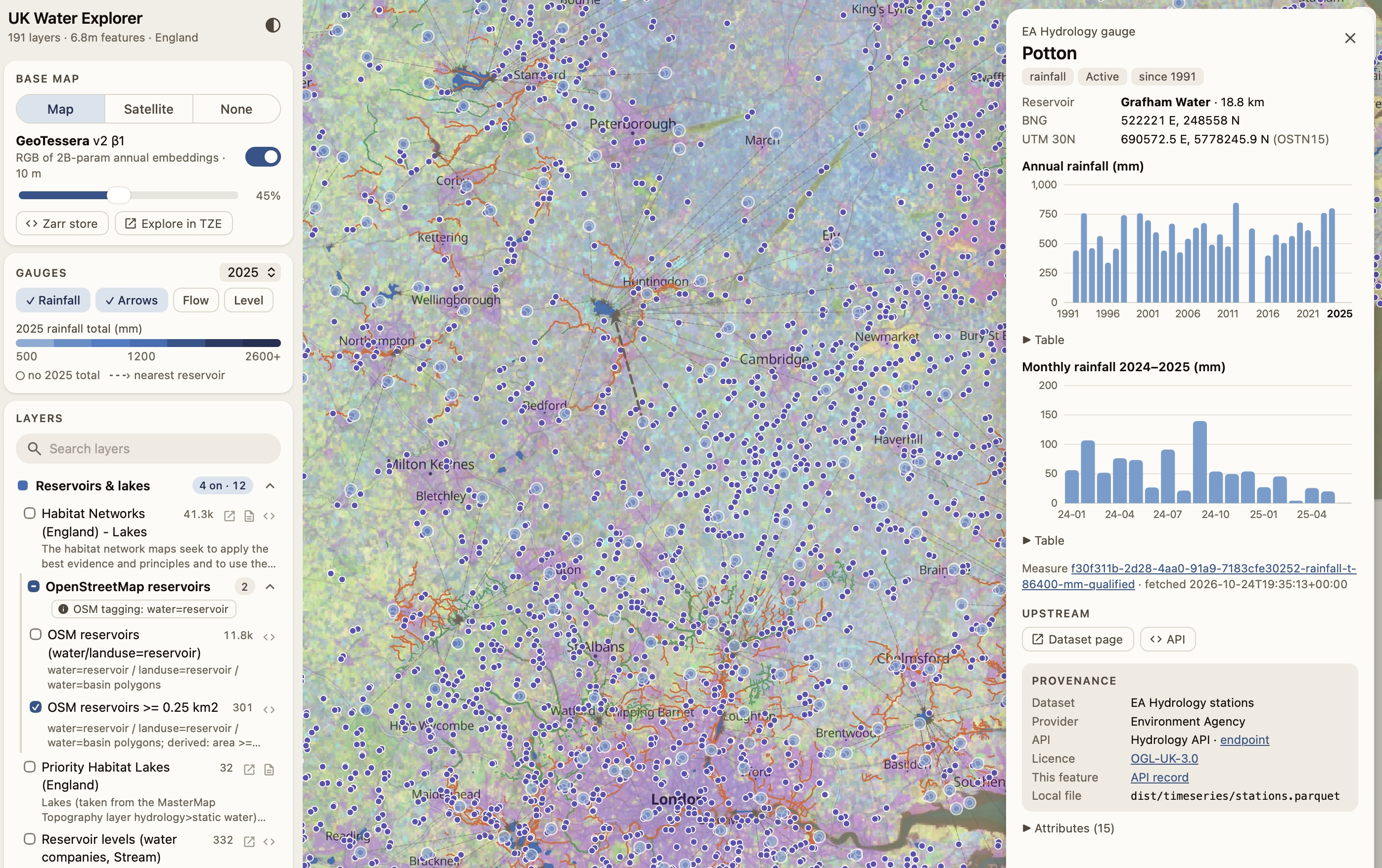
After that, I spidered the NDL with some (carefully rate-limited) local agents and found various APIs for:
- Lidar surveys: 2 m DTM composite, first-return DSM composite, vegetation object model; and tiles via the survey data download. These give us very fine terrain models but only over some years.
- The National Forest Inventory 2023 and 2022, trees outside woodland from Defra, and ancient woodland from Natural England.
- Habitats and soils data along with a priority habitats inventory, the Living England habitat map, peaty soil extent, agricultural land classification; and a CASI and LIDAR coastal habitat map.
- How sites are designated by Natural England with a sites of special scientific interest, the national nature reserves, Ramsar, Country Parks; and RSPB's Important Bird Areas and reserves and heathland extent and potential. Some of these are under the Open Government Licence, and others are research use only.
- Then plant atlas info from 2020 such as tetrad presences, hectad presences by period, hectad trends, native status, conservation status, and phenology.
- There are also ancient tree registries from the Woodland Trust Ancient Tree Inventory and the Tree Register champion trees.
- Going back to water, I got more info from the Environment Agency on main rivers, storm overflows 2020-2025, historic flood warnings, coastal erosion risk; and the water quality archive. This complements the EA hydrology data above and is all available via nice APIs or downloads.
- Landfill data, both currently authorised and historic site boundaries
- Air quality got a look in as I have an air quality project idea with 1km background concentrations from 2003-2024 for NO2, NOx, PM, ozone, SO2, and benzene; and even AURN hourly site data.
- I also grabbed base maps from the Ordnance Survey OpenData on terrain types, Open Rivers, Greenspace, OpenMap Local, Boundary-Line, Open Roads, Zoomstack, and Open Names. Phew!
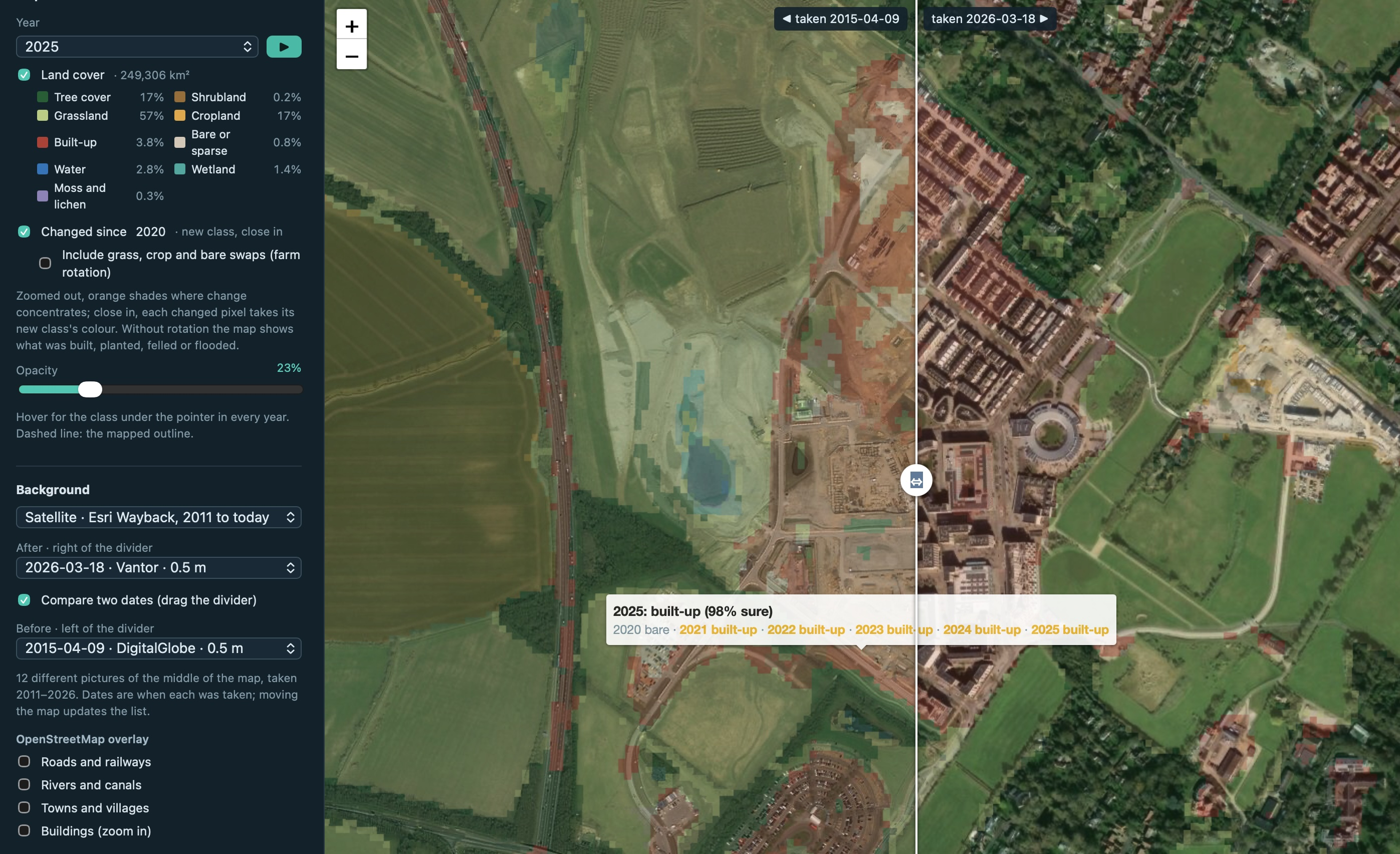
I'm just putting this enormous (and growing) dataset together into one DuckDB instance and a tileserver along with GBIF. It can't be easily redistributed I think, as there are a lot of competing licence terms in there I need to figure out first. However, just the list above is quite useful to get started. I put together a quick Tessera WorldCover 10m downstream task and hooked it up to the Esri Wayback service (to verify historical satellite data) and it's looking very promising so far.
2.1 Hosting and sharing these on Tangled
For the longer term, we'll need a way of sharing these datasets online. I'm very excited that Akshay Oppiliappan launched a big upgrade of Tangled code hosting with lots of new features. Most importantly, the self hosted code hosting knots that I run for both Recoil and the Computer Lab are now upgraded to a fancy new Rust based one that is not only faster, but also supports Git Large File Storage!
Akshay is planning a rollout of private repositories in Tangled in the next month or so, which means that we'll have all the pieces necessary to store large files under version control in infrastructure we run, and to share it selectively with a shared social graph using the AT Protocol. This could revolutionise how we can harmonise all those datasets above into a shared commons. Now that Cyrus Omar is settled in, we've been having regular brainstorms about how our earlier ideas on Fairground and Bastion could fit together here.
2.2 Tessera shortlisted for an OpenUK award
Tessera has also been shortlisted in the software category of the OpenUK Awards 2026, alongside titans like Cilium, Flux CD and StackHPC. The awards ceremony and gala dinner is at the House of Commons on Thursday, so I'm going to don my tuxedo and practise my Oscars^H^H^Hacceptance speech on behalf of the team (and cry theatrically if we lose, of course).
3 Papers and whatnots
Beatrice Spence and Arissa-Elena Rotunjanu gave a splendid practice run of their ZoologyCon 2026 oral presentation to the Zoology group here in Cambridge. Their talk is on DoME, a low cost and high throughput rig for the 3D digitisation of insect collections, with Anna Yiu, Tiffany Ki and Edgar Turner. The conference runs from 4th-7th November in Bucharest, with their slot on the Wednesday afternoon in case you are attending!
Max Carroll finished his POPL 2027 camera ready changes for his type slicing paper and we submitted those to the portal. I've also been helping Josh Millar with his latest work on test-time adaptation, and Patrick Ferris on next generation shells, so there's been a lot of fun computer science in the past few weeks! A lot of my contribution here is just storytelling these days, while the heavy technical lifting is taken on by the key authors.
4 Links around the web
Various discussions about the use of AI in academia rumble on here in Cambridge, with the ever changing landscape being difficult for universities to keep up with. John Palfrey wrote an excellent note on the recent resignation of the Provost of Dartmouth College over undisclosed AI use in his writing:
Given the power of the AI tools that exist today and all the more so given the astonishing speed of recursive self-improvement in the frontier labs, the development of new knowledge is increasingly not being done by human brains, but rather directed by humans and performed by machines.
If I’m right in this regard, then that places even more pressure on setting the right set of rules for academic research and publication — such that we neither limit ourselves unduly in terms of developing new knowledge, nor do we mislead one another or our readers when we fail to disclose the roles we played as human scholars as compared to the machines that have aided us. -- John Palfrey, Nov 2026
My own use of AI varies dramatically based on context (cold turkey ban if trying to learn something, minimal if working on existing projects and mostly for code review, and extensive frontier use for new explorations), so I'm going to put up a web page explaining my personal methods. It changes weekly right now...