
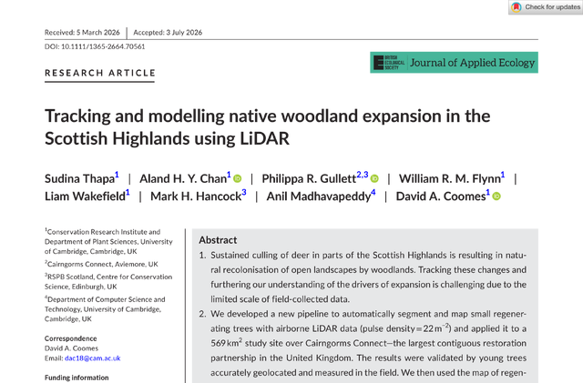
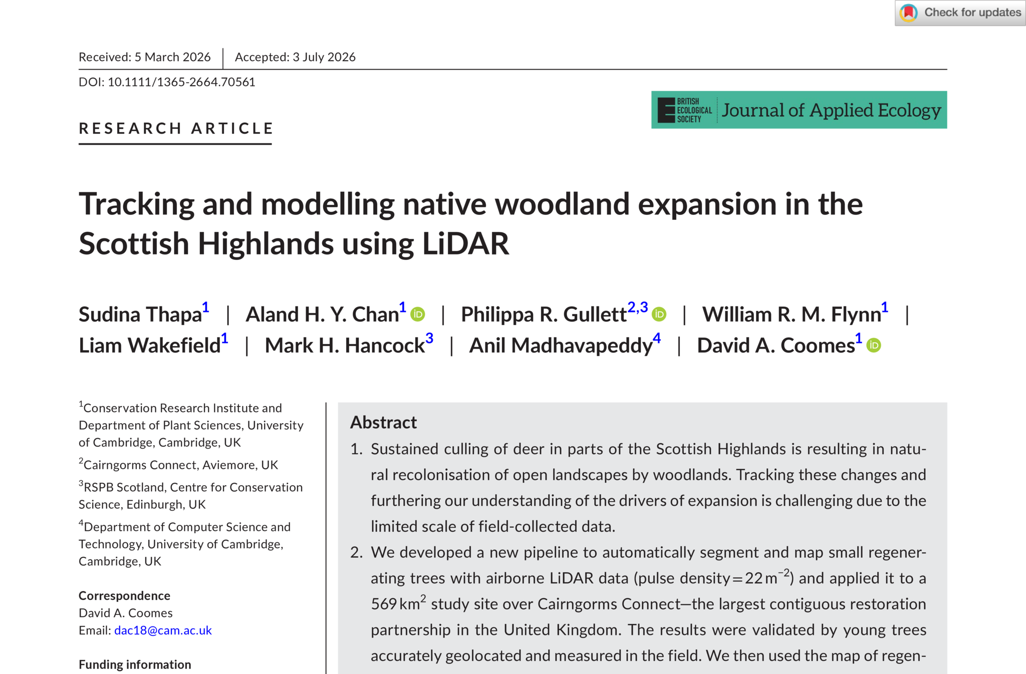
It's been a rough year for wildfires in the Scottish Highlands, so I'm delighted to have some good news in our new paper out today! Using airborne LiDAR, we've found that the native forests across the Cairngorms Connect restoration area are steadily expanding, with millions of new young trees taking root in open ground that has been treeless for centuries.
Tracking and modelling native woodland expansion in the Scottish Highlands using LiDAR, led by Sudina Thapa and Aland Chan in David Coomes's group at the Centre for Landscape Regeneration, is open-access, and the University has published an explainer as well.
1 Oh Deer, oh deer, oh deer
Only about 4% of Scotland's original native forest is still intact, with the rest long since cleared (usually for agriculture) and replaced by heath, bog and grassland. Cairngorms Connect is the largest contiguous nature restoration partnership in the UK, across 60k hectares of the Cairngorms National Park. Their goal is to double the forest extent, ideally through natural regeneration.
So what stops the forest from naturally growing into surrounding land? Deer! Our adorable ungulate friends chew saplings and kill them before they become mature trees. Since fences are impractical over this large an area, the partnership has instead reduced deer through sustained culling so seedlings which would previously have been gobbled could instead grow into mature trees.
2 Commissioning a LiDAR flight
What our paper does is to help evaluate the efficacy of the intervention. Field surveys of saplings are obviously labour intensive if we want to cover rough Highland terrain.
So back in 2023, we got in touch with Fugro Geospatial to commission an airborne survey over a big chunk of the Cairngorms Connect area. A light aircraft flew ~600m above the ground with a Riegl waveform laser scanner, and collected a LiDAR point cloud for us along with 10cm resolution RGB and near-infrared aerial imagery. This dataset has since fed into a number of projects at the CLR, from shrub ecology and carbon to deadwood detection.
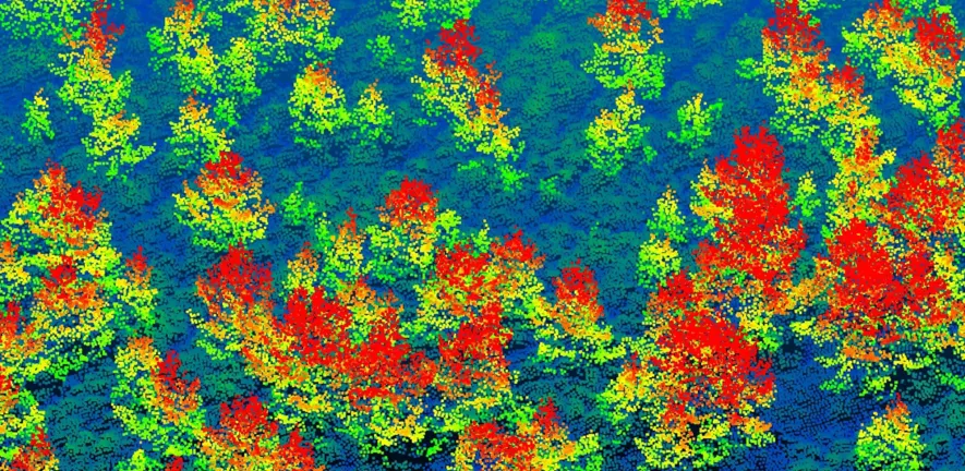
Once the survey came through, data processing was quite a bit of computation. The full set of imagery was around 6TB raw. The LiDAR itself was excellent, but the first orthomosaics we received were off by 2-5m in their coordinates, which was enough to misalign roads (and obviously trees). While conventional photogrammetry tools can fix this via "tie points" across overlapping photos, this is difficult to do with trees at different angles. We therefore went back to the original images and reconstructed the mosaics ourselves.
The analysis pipeline is subtle because saplings are about the same height as heather and bracken. Conventional classification algorithms tend to lump small objects into the ground, so Aland built a processing pipeline that preserves smaller features in the canopy height model. This was actually too sensitive as it also detected lots of bracken, so Sudina subtracted the local average height to remove it before singling out treetops and delineated tree crowns.
We validated this against trees that were manually geolocated+measured. Clusters of regenerating trees started to become detectable as soon as they outgrew surrounding shrubs, with 83% detected at 1.4-1.6m and over 95% above 1.8m. This is happily right around the 'deer chewing' line, so our method can find the trees that have "escaped" and will likely grow into mature woodland.
3 Seeing the trees for the woods
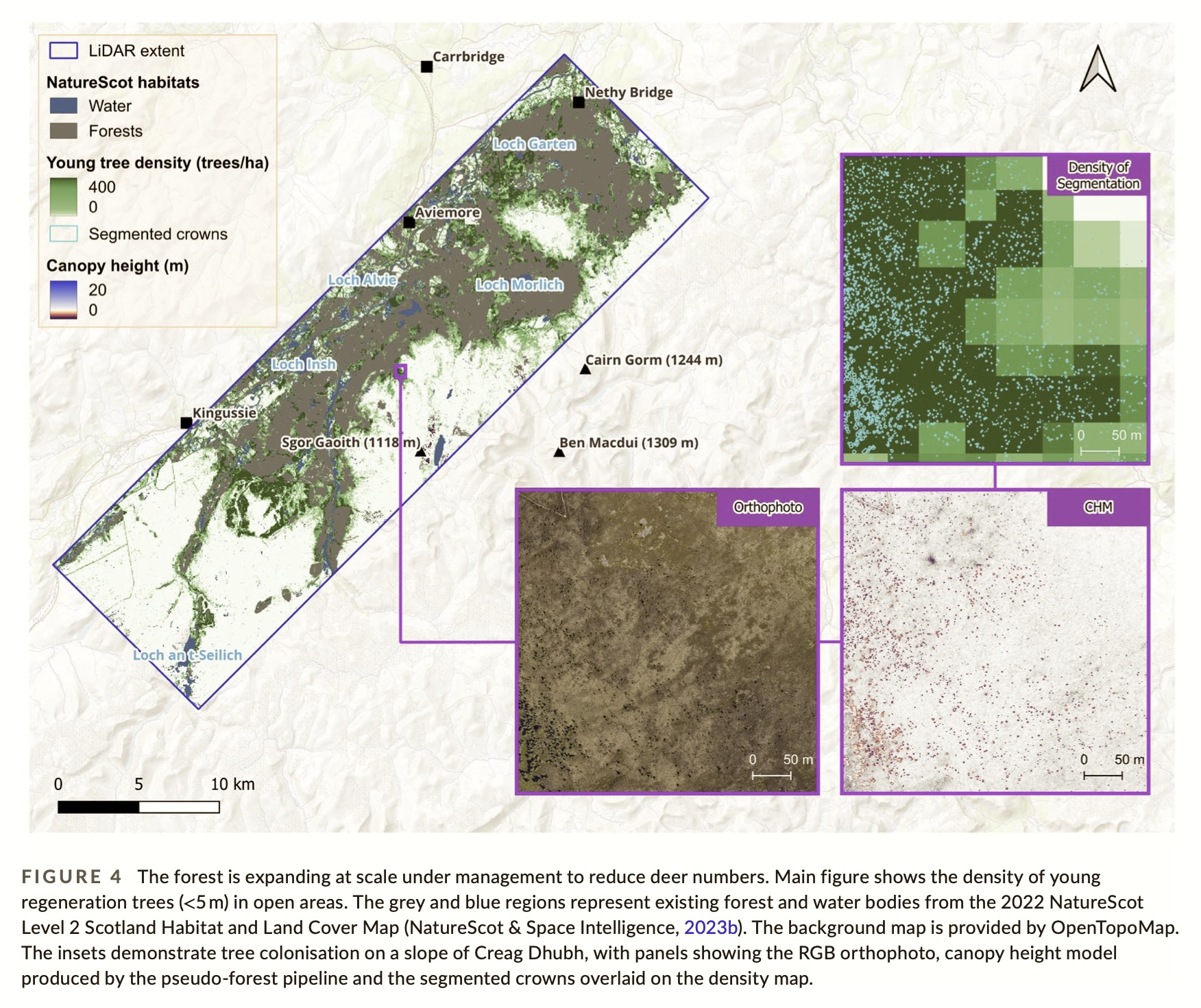
We found >6 million individual trees in the region, of which 2.65 million were young trees under five metres tall. The good news is that a large swathe of previously open land now features young saplings with a good density, largely established naturally.
"The ability to map regenerating trees so precisely, at such a huge scale, is a breakthrough for monitoring nature restoration at a landscape scale. It means we can effectively map young trees, assess whether restoration targets are being met, and inform future restoration work." -- Aland Chan, 2026
We then fitted a model to identify the drivers of successful regeneration. Most young trees cluster near edges of existing forest, although some plucky pioneers are growing further away. Elevation, habitat type and deer density also all strongly affect establishment; fewer young trees take hold in boggy areas. Overall though, total woodland has definitely increased in areas where deer control took place, yay!
4 What next after the fires
The Scottish Government is now funding a fresh national airborne LiDAR survey, which is obviously excellent news as we could only rustle up funds back in 2023 for a small swathe (thanks to Tarides for that!). On the computing side, David and I are learning from Michael Dales recent work on visualising lidar to combine it with Tessera. LiDAR flights are expensive even with the government involved, so the more we can leverage much more easily accessible satellite data, the better our tree counts will be.
Well done to Sudina, Aland and David for seeing this through over the past three years, and many thanks to all the partners in Cairngorms Connect and the field teams who spent many hours manually measuring saplings deep in the heather!